With the Lake Mead water levels dropping so quickly, it’s no wonder why the lake has been a popular destination for YouTubers and Journalists to cover all the artifacts that keep turning up. Here’s a list along with locations of the most popular artifacts that you can drive up to and see in person. No boat required!
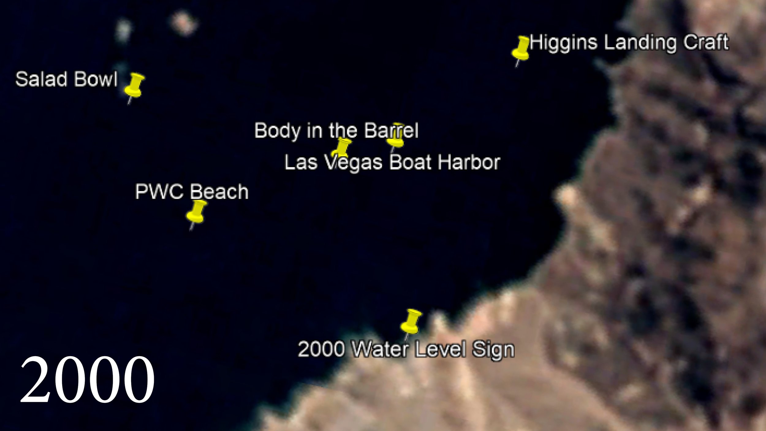
Lake Mead Water Level Signs


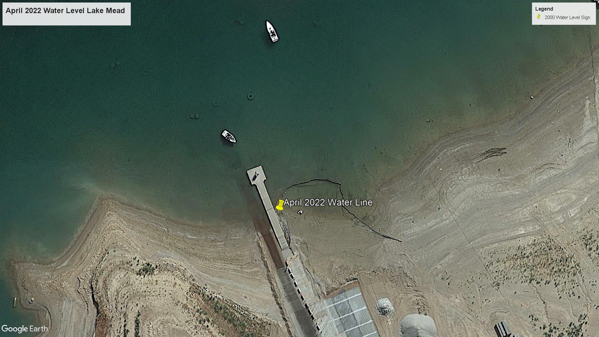
Located at the top of Hemenway Harbor boat launch, you can see signs that pin the water location for specific years beginning with the year 2000. From that point, drive down the boat ramp toward the water to see the water levels of the following years down to 2021.
Coordinates: 36°01'36.6"N 114°46'54.8"W
See it on Google Maps
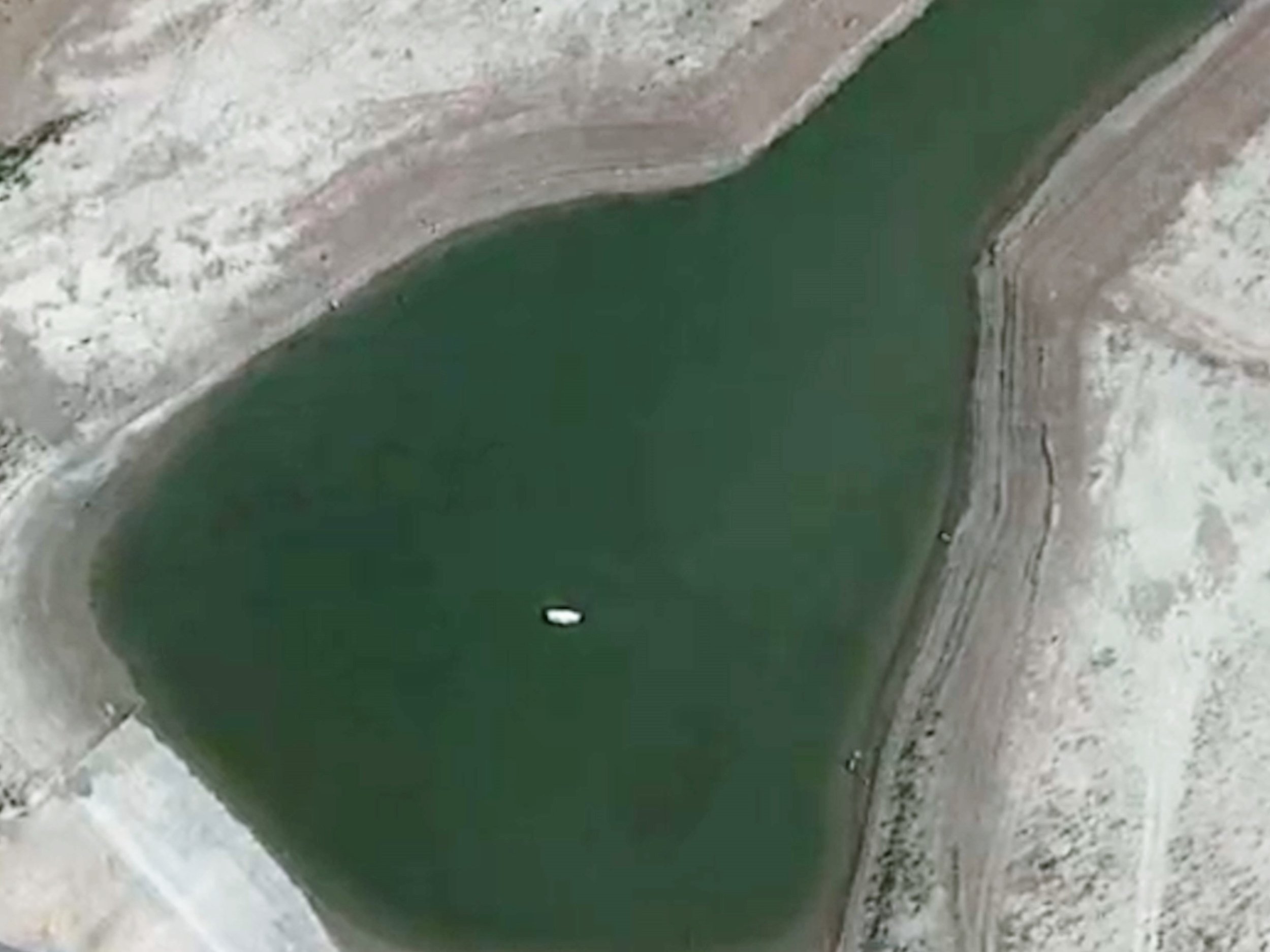
Lake Mead water level July, 9 2022

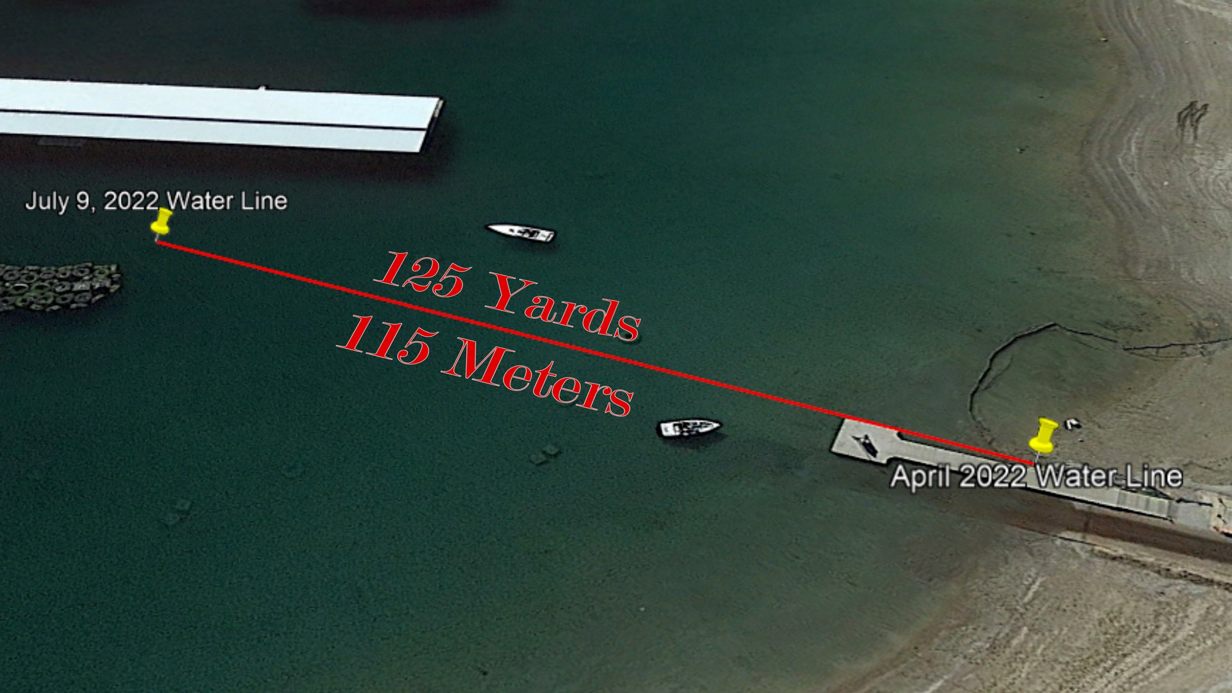
It’s crazy to see just how fast the water level is going down at Lake Mead. Just 3 months after the satellite image was captured in April of 2022, the water has receded to the point that on July 9, 2022, the water level was 125 yards further down.
If you travel down to the launch, compare the water level at the time you’re there to the other two locations. It may look like both locations are under water, but they definitely are not.
April 2022 Google Maps | July 2022 Google Maps
The Body In the Barrel
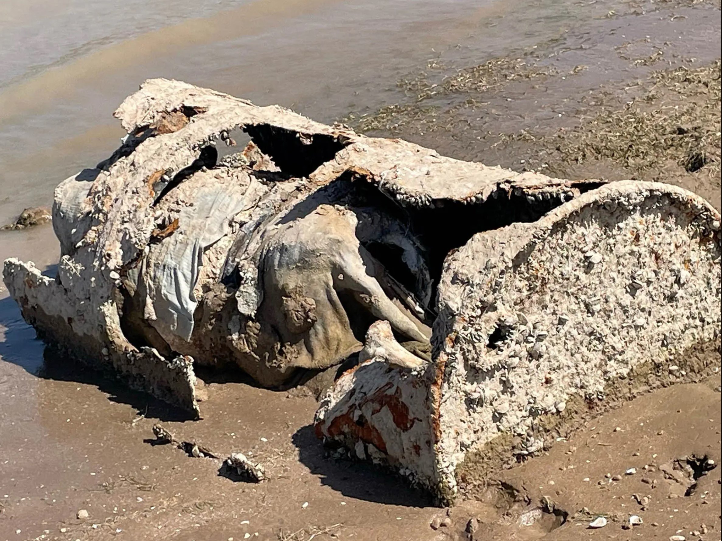
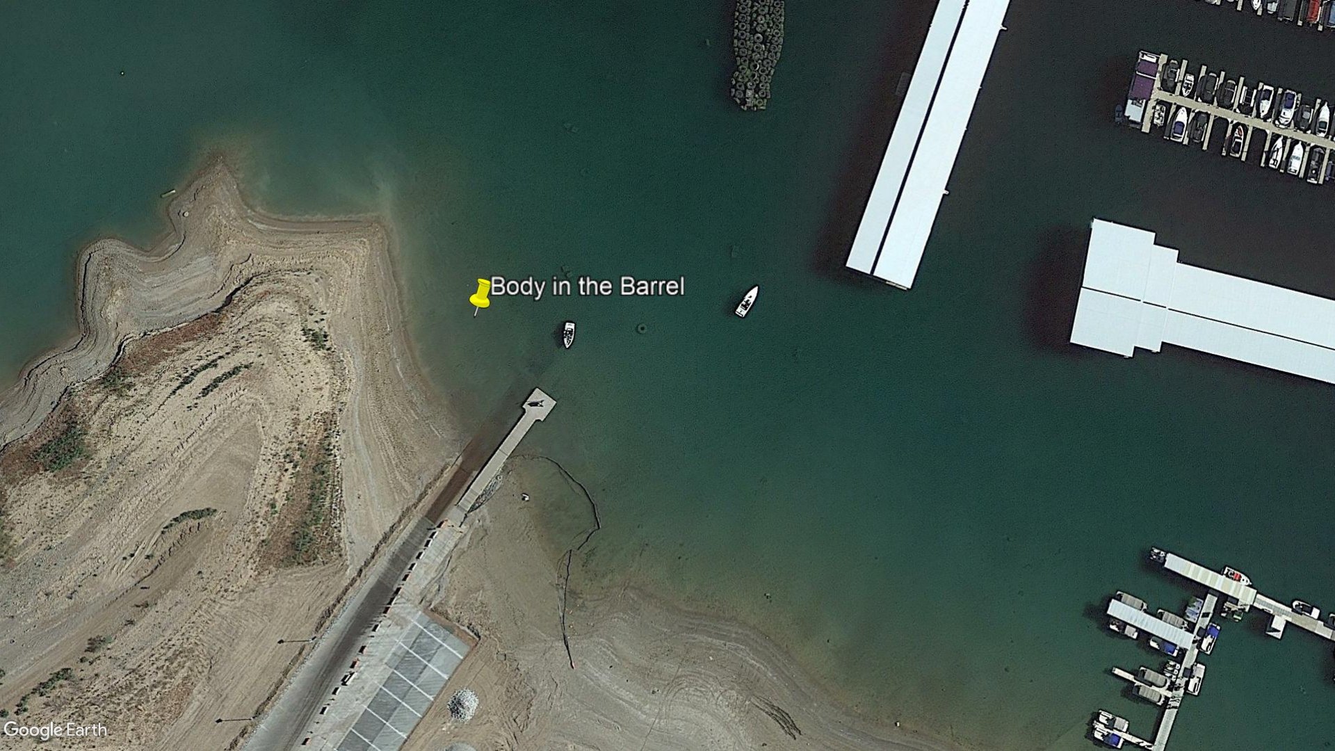
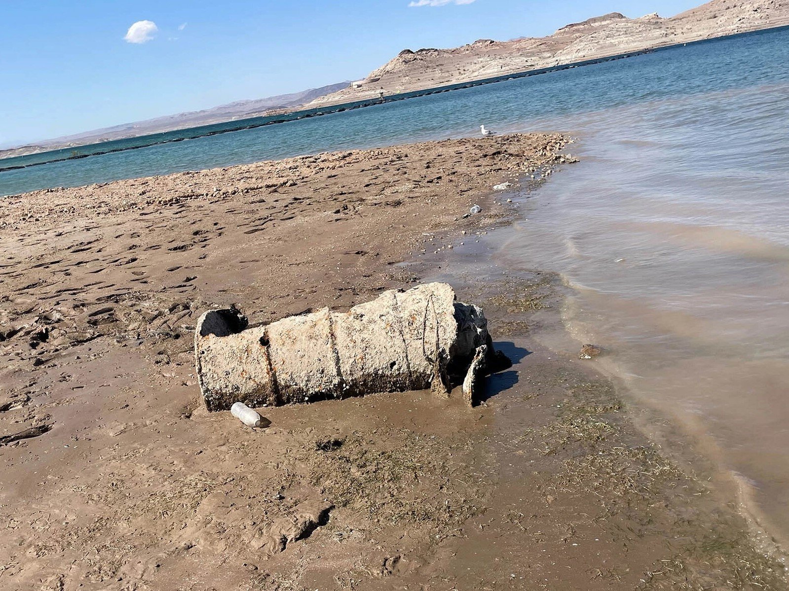
On May 1st, 2022, a rusted barrel containing a body was found near the boat launch at Hemenway Cove. What’s crazy about this is I remember hearing stories about the Mob dumping people in the lake as a kid. Turns out the stories were true which is why I never wanted to swim in the lake. The Mob Museum has a cool article on this (worth the read).
Approximate coordinates: 36° 1'52.97"N 114°46'25.00"W
See it on Google Maps
Feed the Fish & Get Some Food

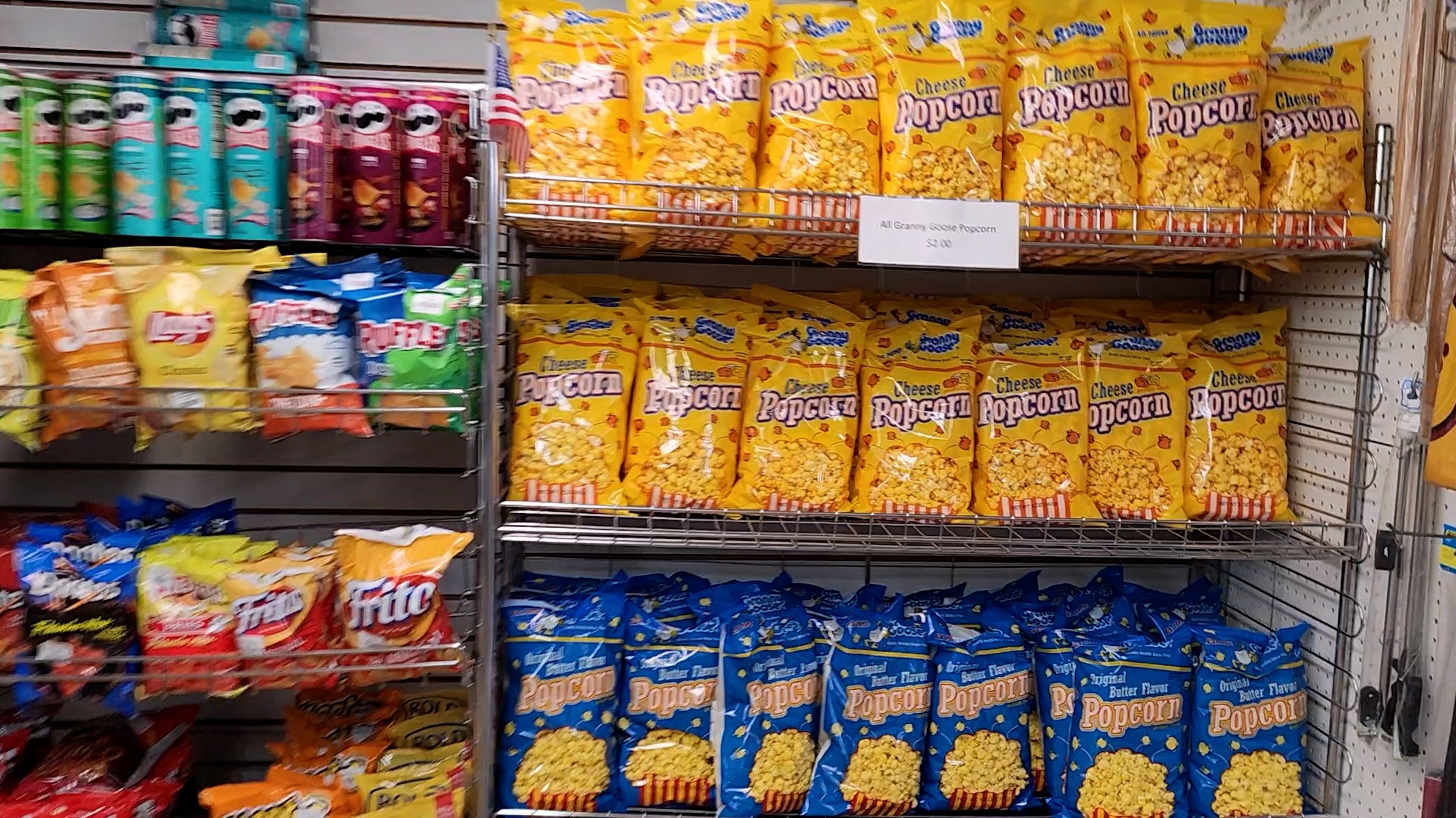

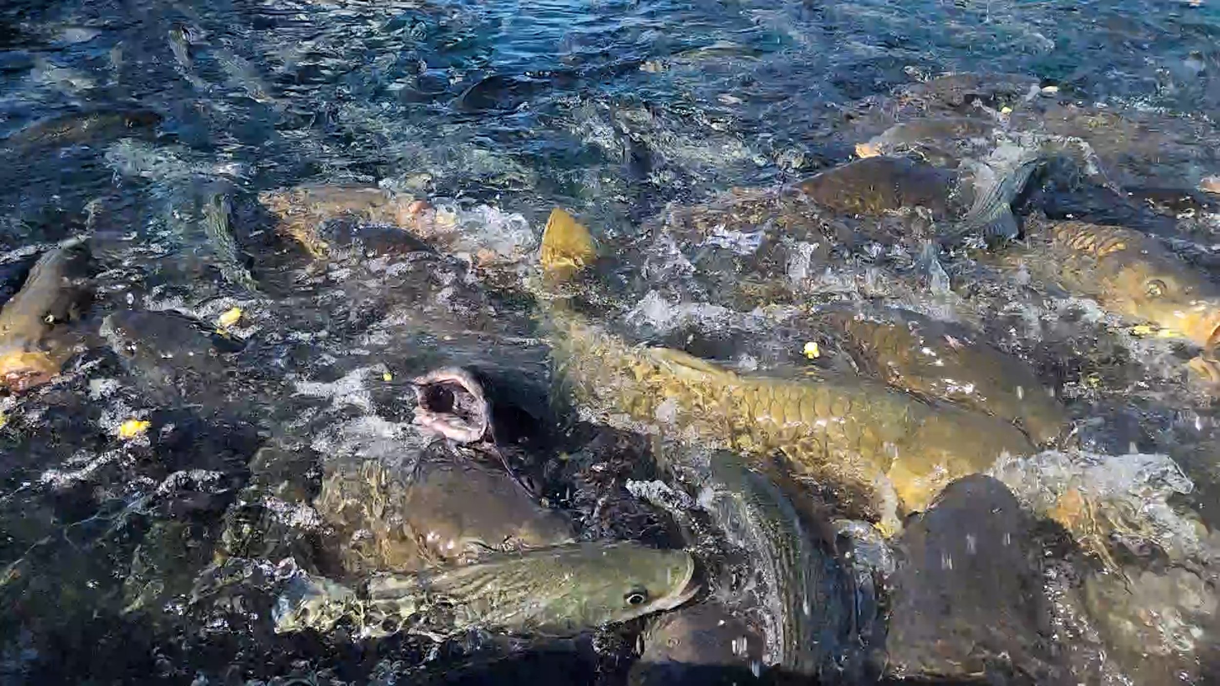
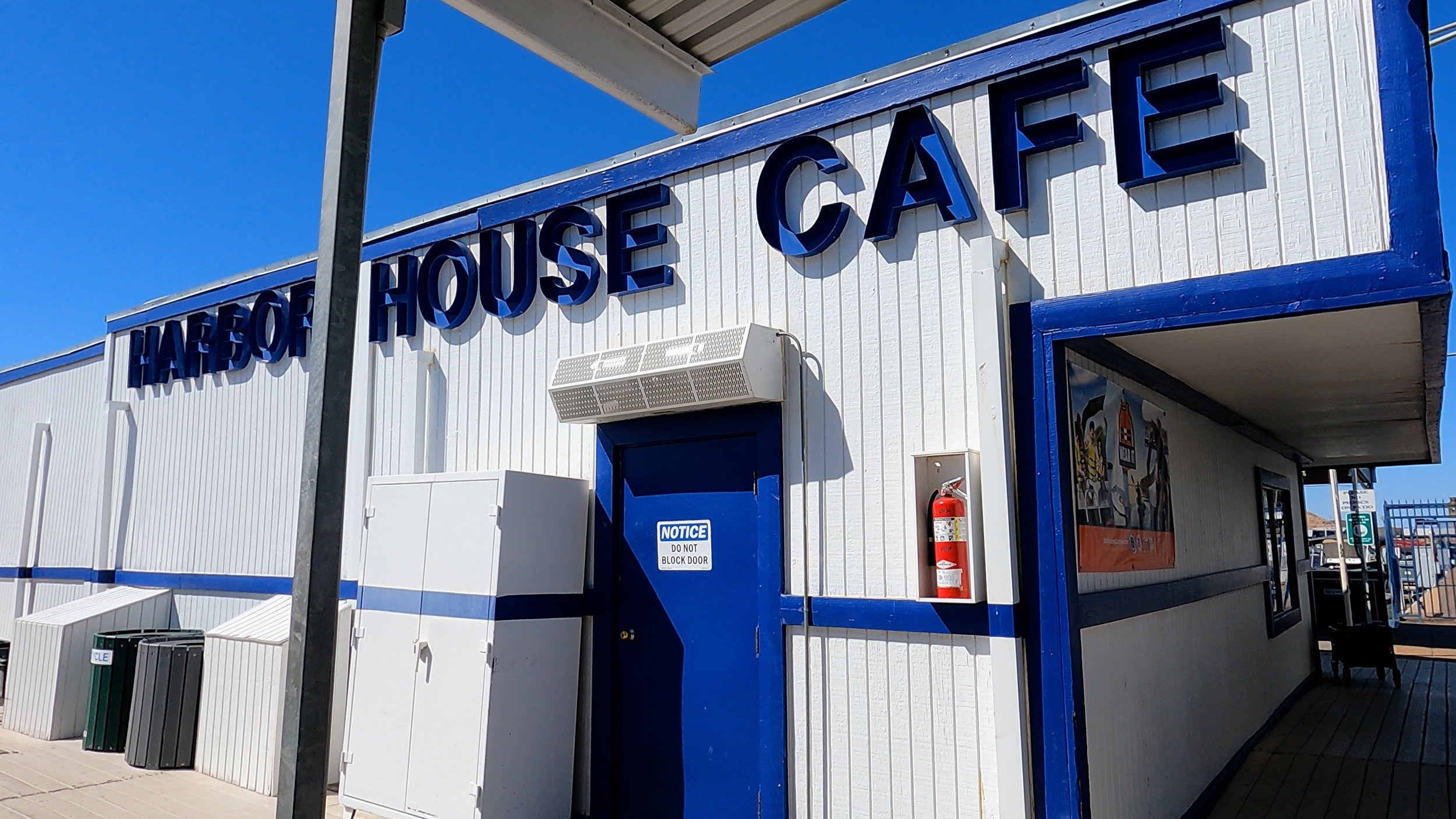

Feeding the fish is one of the coolest memories I have as a kid. Even my kids love it. Carp, Striped bass and Catfish are common in the harbor, and they go crazy over popcorn. The popcorn rack can be found in the store next to the cash register. Grab a few bags and watch the fish go wild!
Across from the store is the Café. The food is good, the drinks are cold (and made generously), and the staff has some really cool stories to share about the lake. This is a family owned harbor and they have seen A LOT! Show your support and learn something new.
The address to the harbor is:
490 Horsepower Cove, Boulder City, NV 89005
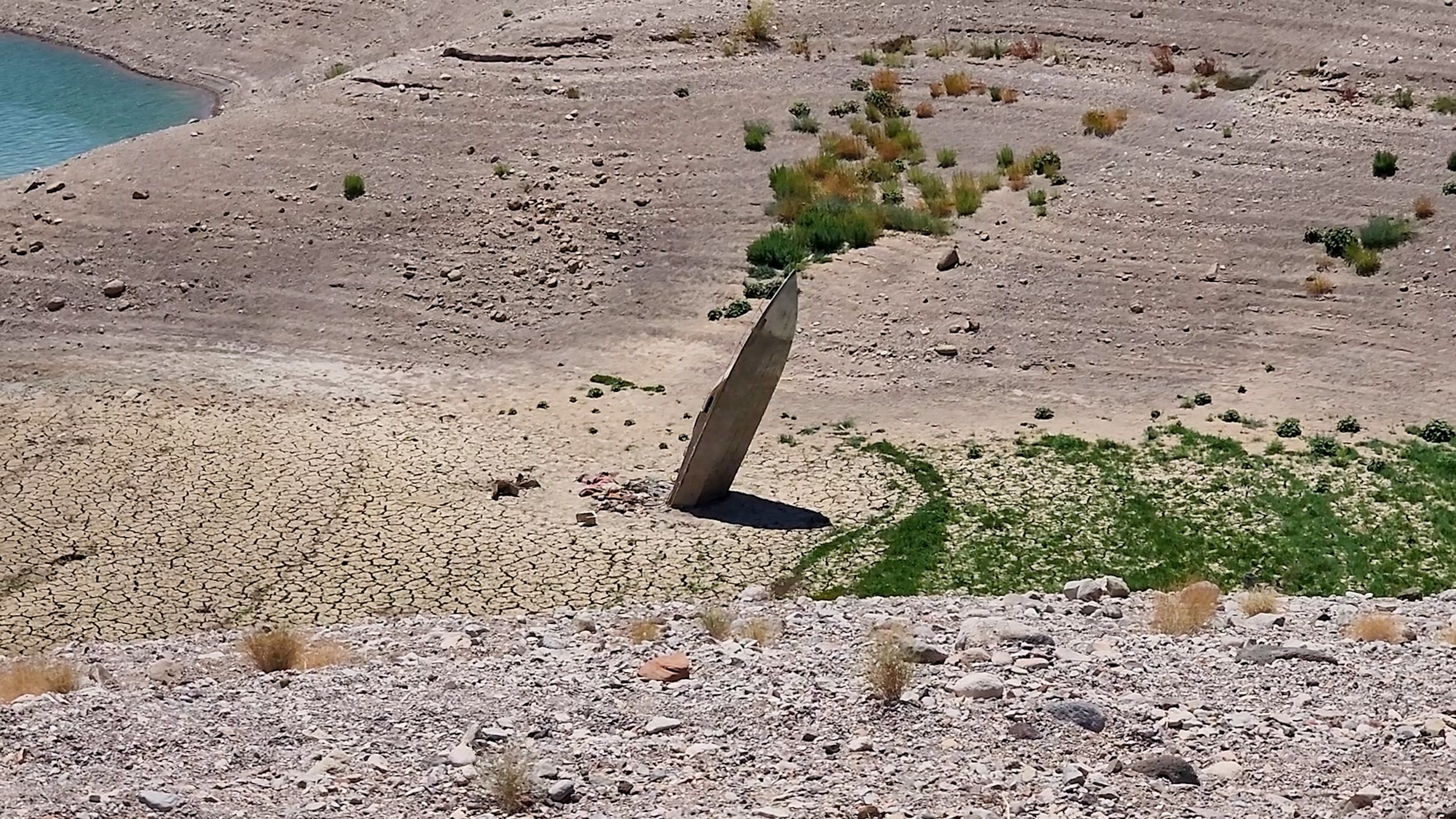
Higgins Landing Craft


Stories of the Higgins Landing Craft in Lake Mead var. It may or may not have been used in a war, it may or may not have been sunken on purpose, and there may or may not be more on or in the lake. It really depends on who is telling the story. Either way - you can see it! The hike is not far, but the terrain is soft and hilly with no shade. Bring plenty of water..The location is approximate, but I’m sure it’s really close.
Approximate coordinates: 36°01'27.2"N 114°45'57.5"W
See it on Google Maps
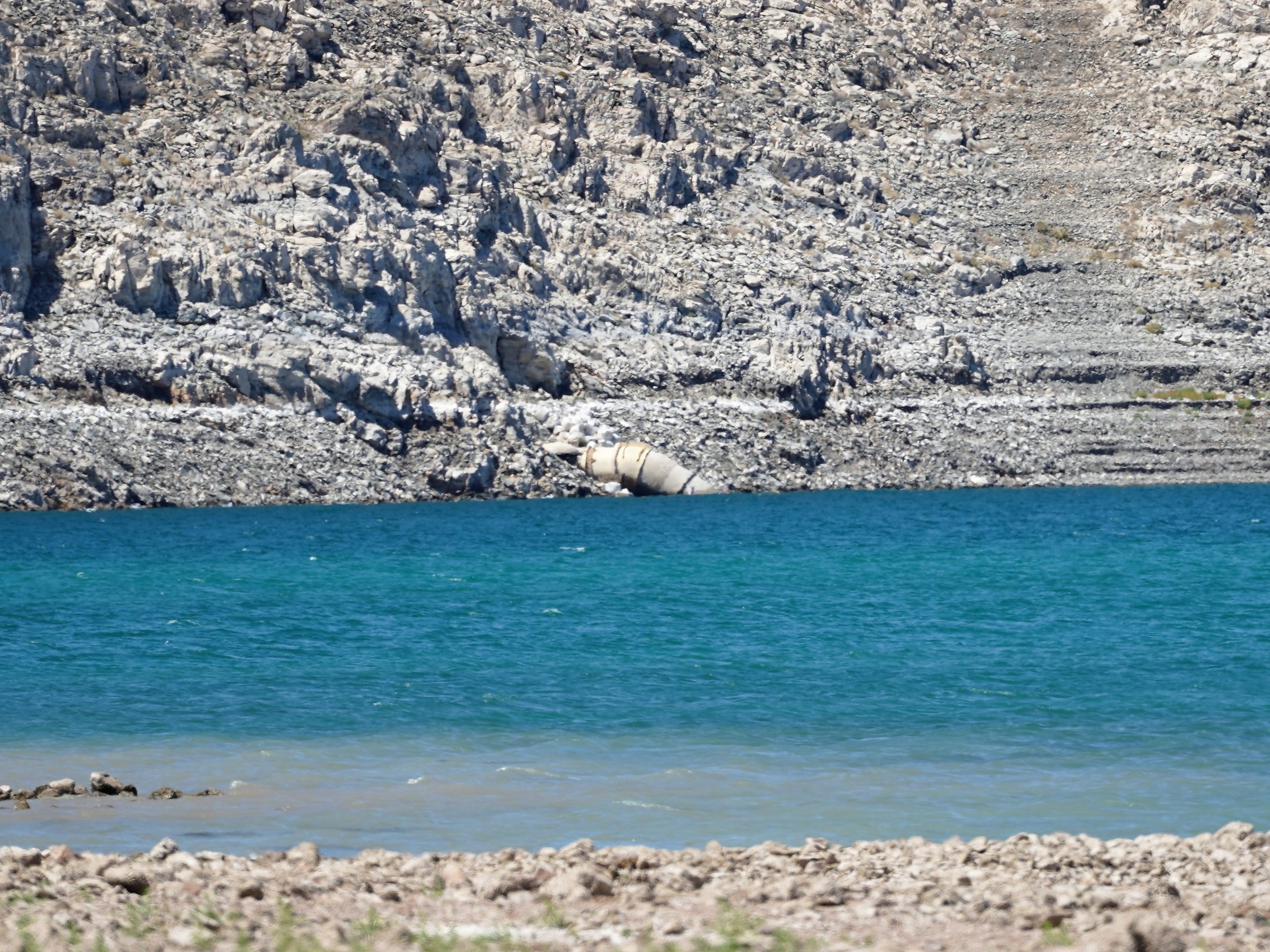
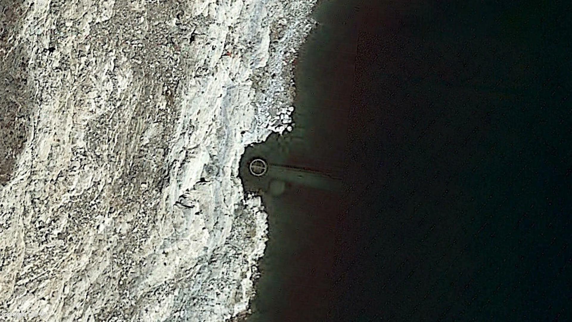
“The Salad Bowl”
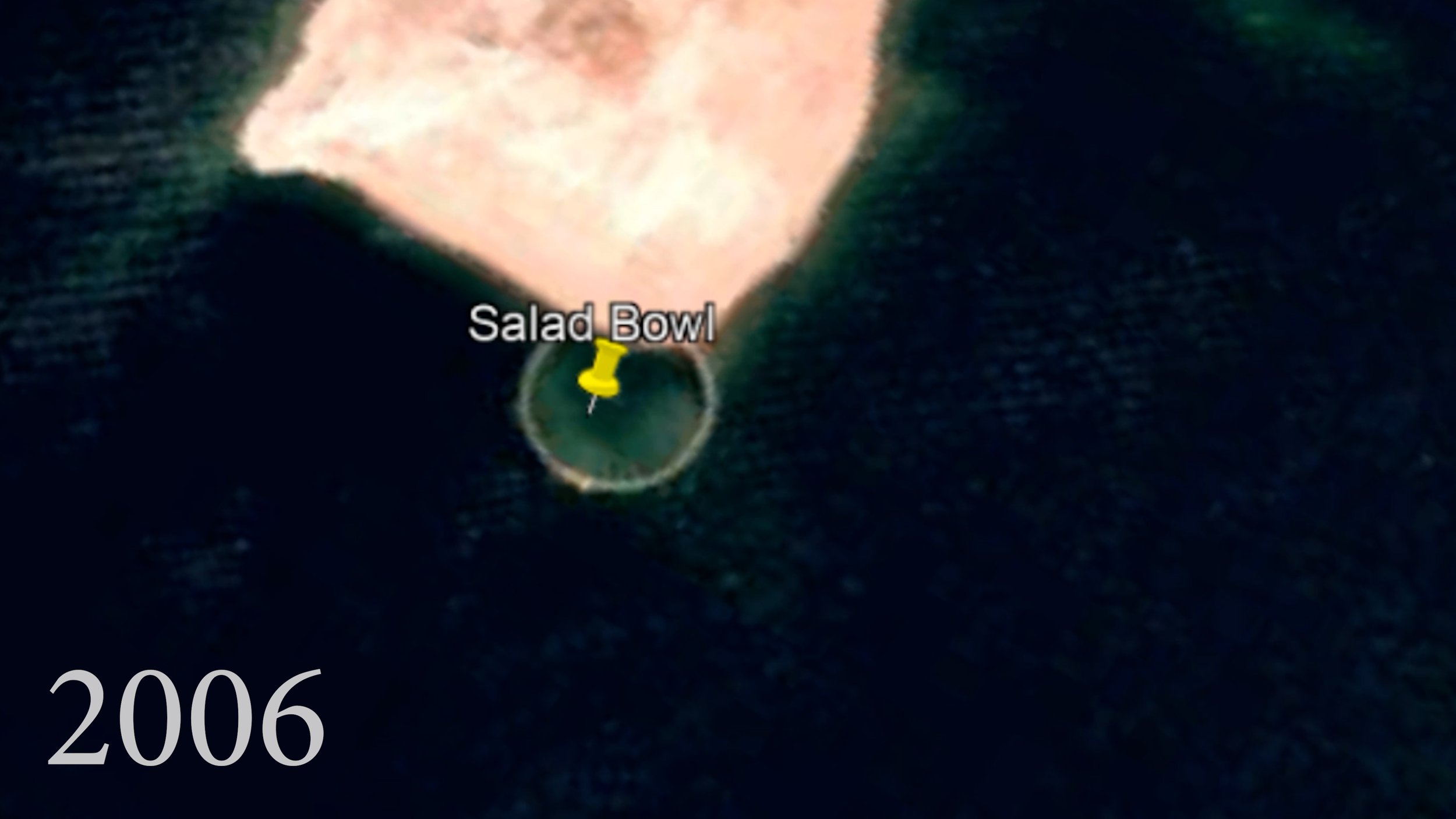


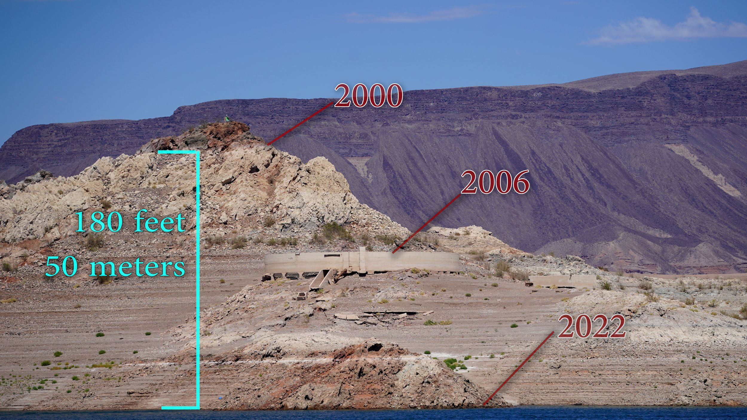
Since 1937, the batch plant used to help construct the Hoover Dam has been under water. In 2006, the water level had dropped far enough to reveal one of the water clarification tanks which used to be a popular dive site. You can’t access it by car, but you can see it clearly from the shore of the Personal Watercraft (PWC beach. Just imagine that where you’re standing would have been about 180 feet (50 meters) under the water in the year 2000.
Coordinates of the PWC viewing point:
36° 2'12.90"N 114°46'42.89"W
PWC Viewing Point on Google Maps
Actual Location of Tank on Google Maps
Las Vegas Water Intake
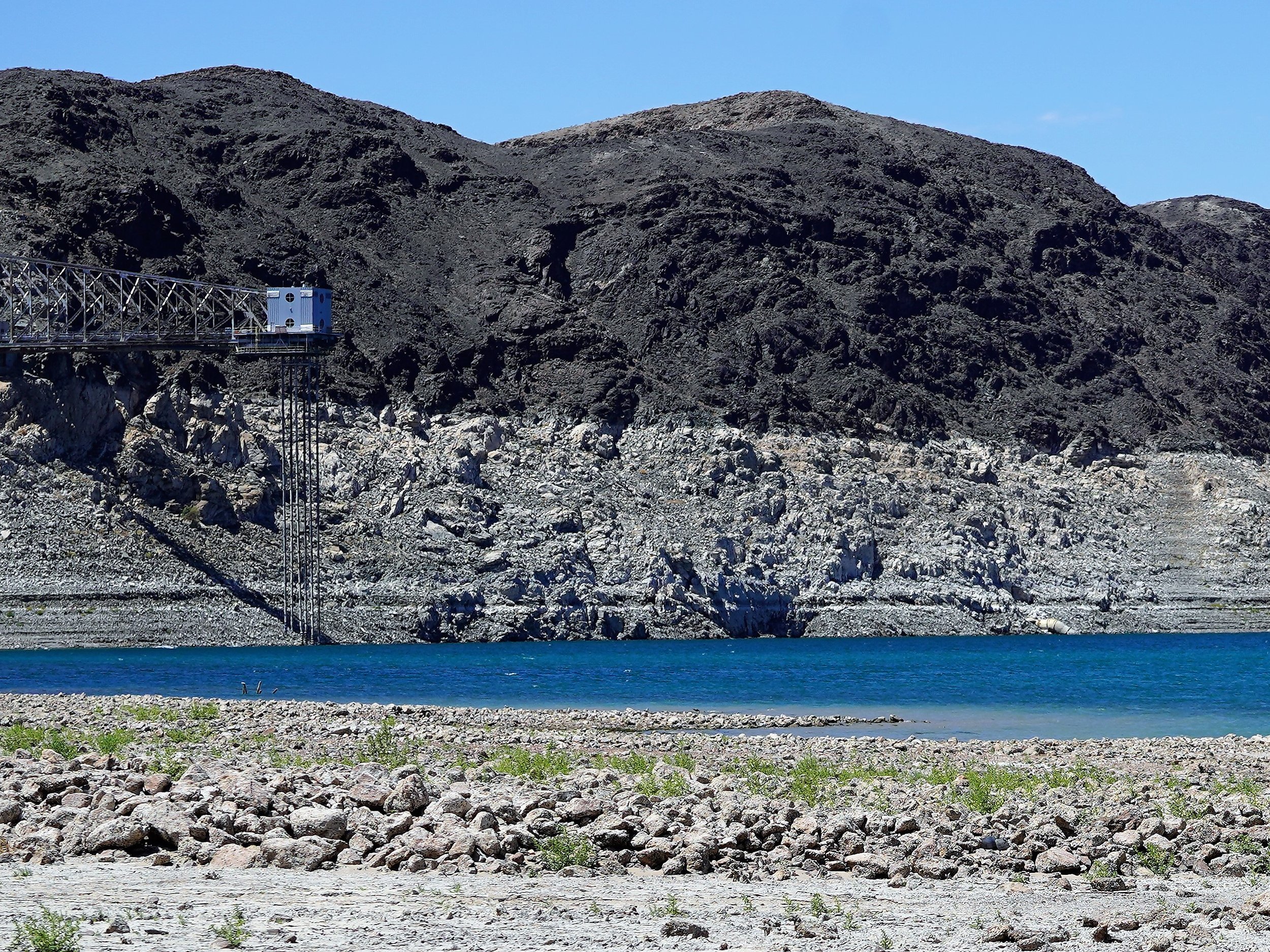
On April 4, 2022, the Las Vegas water intake number one became exposed. There are 3 intakes for the Las Vegas water system. Intake 1 was built back in 1971. Believe it or not, homes back then tapped wells into the desert for drinking water. Intake 2 was built in 2000, which is the beginning of the 22 year drought we’re experiencing now. Knowing this, intake 3 was complete in 2020.
The Las Vegas water intake (and tower) are secured from land traffic and not accessible by foot. However, you can see it from the North Boulder Beach pin if you look to the right of the cantilever water tower hanging off of saddle island. You can also get close to it with a boat.
Fun Fact - According to a couple servers at the Harbor Café, there was a rope swing attached to the water tower and people used to hang out there back in the late 1970 and early 1980’s. Sound like it would have been fun.
Coordinates of the North Boulder Beach view point:
36°02'54.8"N 114°47'39.4"W
North Boulder Beach View Point on Google Maps
Intake One actual location on Google Maps

Boulder Harbor
There once was a boat at the bottom of Boulder Harbor. It’s not there anymore.
However, the cracked up silt bed is really cool to go explore and walkaround on. Heads up, though, metal detecting, drone photography, and taking items from a national park is illegal. Just don’t do it.
Boulder Harbor Coordinates: 36°03'13.2"N 114°48'16.3"W
See it on Google Maps
The Jet Boat
The world famous Jet Boat. In recent time it has been referred to as the “Las Vegas Monolith” or “Lake Mead Monolith” by the locals. What makes it so interesting, aside from how it sank in 86 year old mud, is that the items it sank with were neatly preserved by the water.
Everything from pieces of the boat interior, to clothing, to beer cans and boxes still remain as a time capsule at the time of this video.
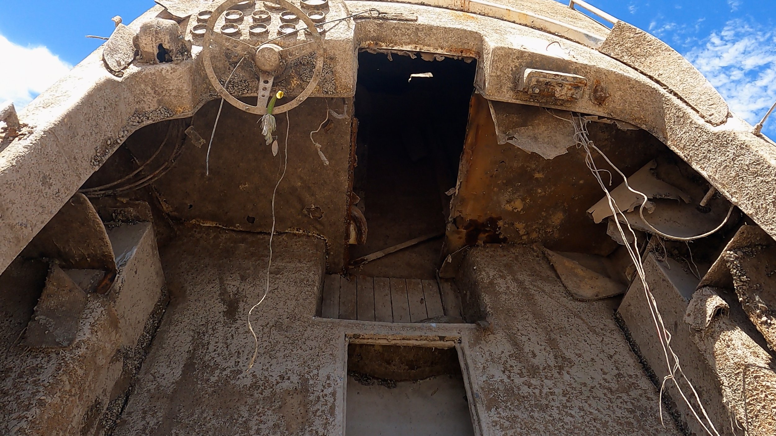
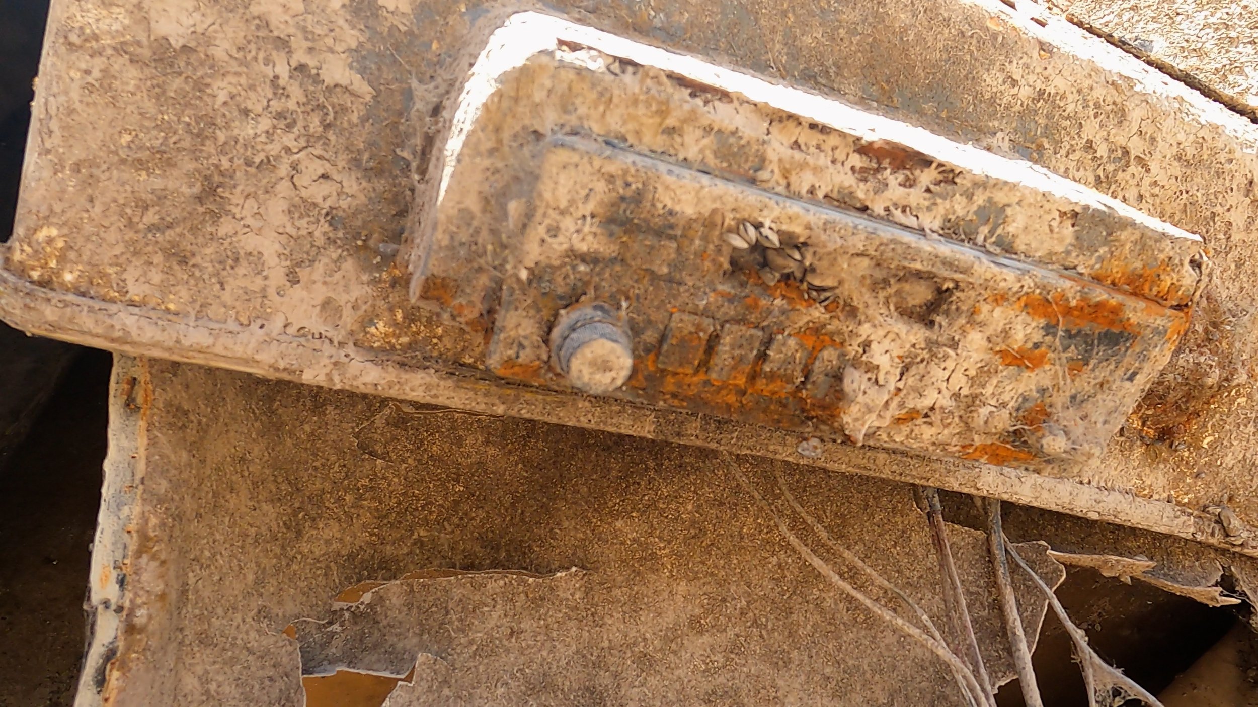
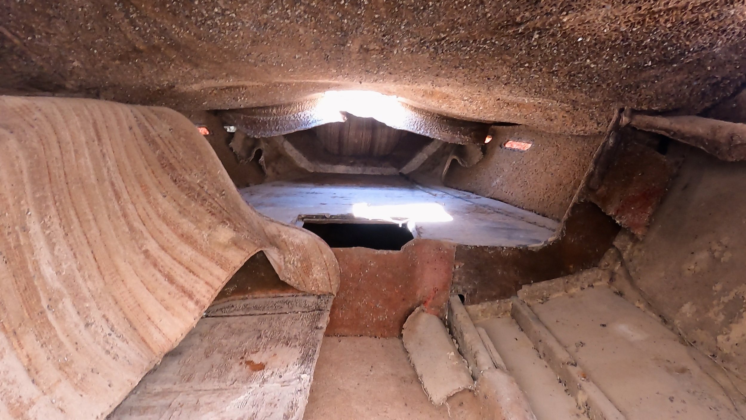
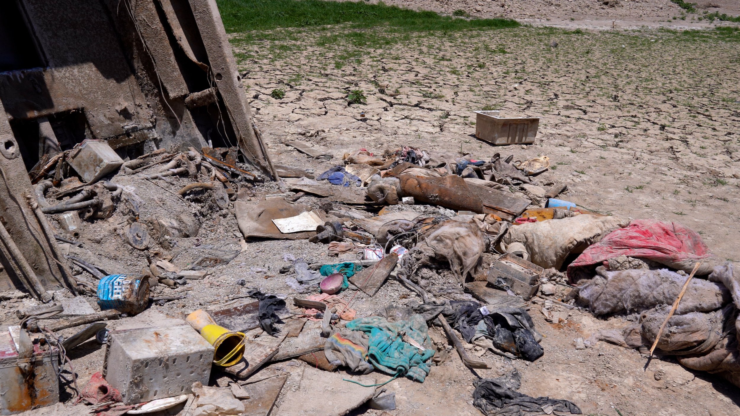
AND WE WOULD LIKE TO KEEP THEM PRESERVED!
If you take the journey - please leave everything as is.
The jet boat is located at the end of Government Wash. If you follow the road all the way to the end, and find the dirt road turn off, you’ll eventually arrive at the 2WD pin linked below. If you don’t have a capable 4 wheel drive vehicle, park here and hike down the trial.
If you have a capable 4WD vehicle, work your way down the hill to the 4WD parking pin linked below. The hill is steep with soft dirt and stones lining it, so be honest about your capabilities. Going down the hill is easy - going up could get you stuck.
Bring food and LOTS of water. There are NO SERVICES in or near Government Wash. Cell phone coverage is based on your carrier. AT&T was about 3 bars in 4G


Jet Boat Coordinates:
36°07'08.5"N 114°49'48.0"W
Jet Boat 2 wheel drive parking on Google Maps
Jet Boat 4 wheel drive parking on Google Maps
Jet Boat location on Google Maps
EXTRA STUFF!
Because who doesn’t like extras?
Craig Miller’s Boat
The story of Craig Miller getting stranded on a sand bar near Callville Bay broke when Adrian Sr. and Jr. discovered Craig stranded on the small peninsula after breaking down. The water dropped so fast that Craig wasn’t able to make the repairs which left him stuck in the sand.
Shortly thereafter, Diesel Bros came to the Lake and yanked him off the land and back into the water. Craig is reported to be back in or near Callville Bay Marina.
I didn’t bother trying to visit Craig or meet the guy. He’s been through a lot and probably just wants to chill at this point.
The approximate coordinates Craig was stranded on is pinned on Google Maps

The Second Body
Only 6 days after the body in the barrel was discovered in Hemenway Harbor, a second set of skeletal remains were discovered (sans the barrel) in Callville Bay. The two are not believed to be linked.
The second skeletal remains are believed to be a drowning victim who was never located. Legend has it that he took off from Boulder Harbor toward Callville Bay never to be seen again.
The teeth of the remains are playing a vital role in identifying who he is.
This is a random guess where the remains were found on Google Maps

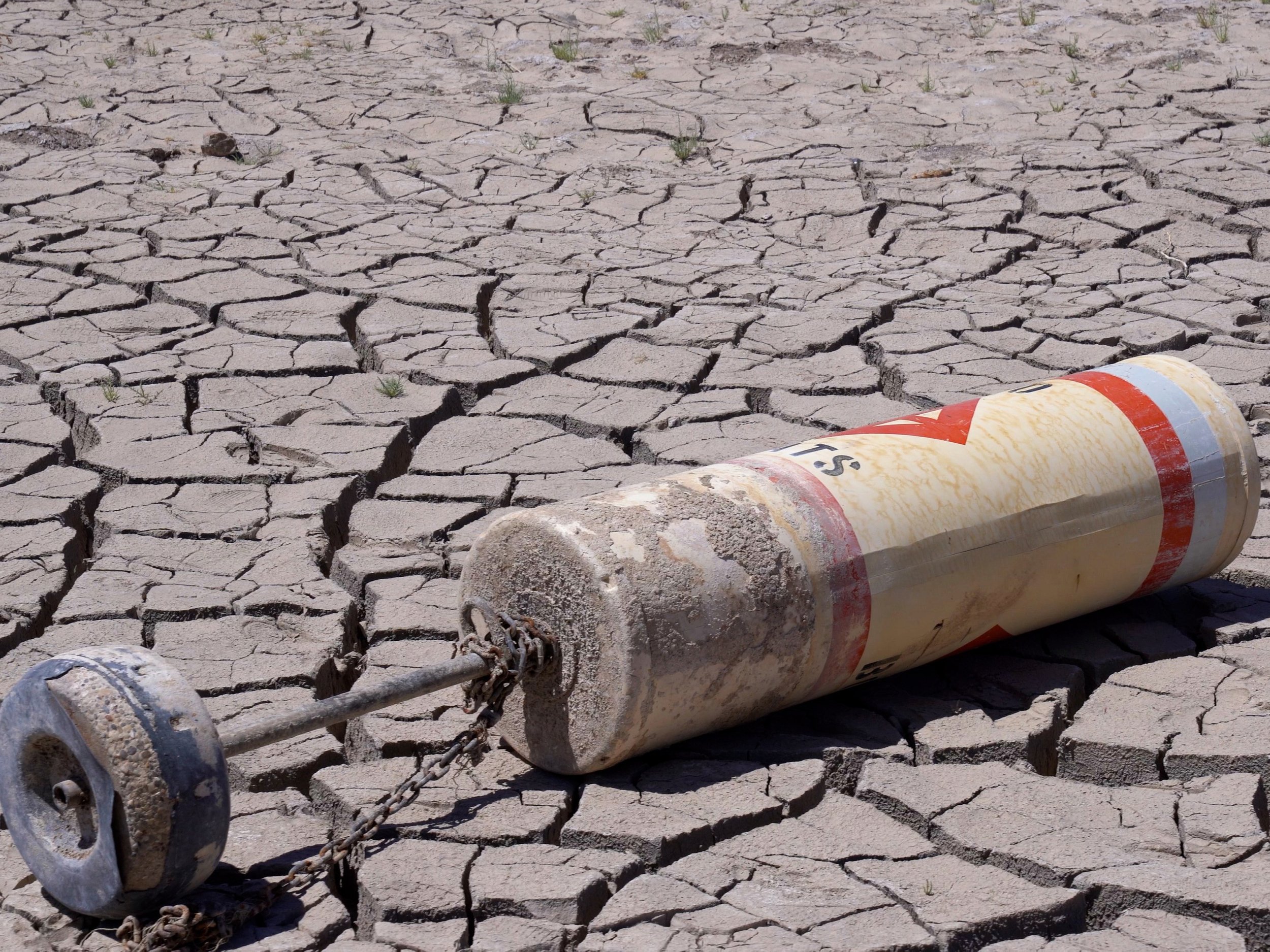
Boats & Barrels
You might be headed to Lake Mead with the hope of finding another barrel or sunken boat.
You will.

Boats and barrels are literally everywhere along the shore line with more popping up every week. They are literally littered everywhere.
One I found exciting was what appears to be an old Glastron retro boat with fins on it sitting in the middle of a field. These types of boats were modeled after actual cars from the 50’s and 60’s. This boat was found on the opposite side of the water near the Jet Boat.

More Jet Boat
If take a close look at the Google Maps pin from April of 2022, you’ll see the top of the jet boat. This is when it was first being discovered. There was basically plenty of time for the water to clean it, people to touch it or scrub it off for a pic, and the sun to cook it.

Just 3 short months later, the boat is completely out of the water. That very short amount of time has basically not given nature or people time to clean it off like the top. That’s why the top is clean.
The clean top might also have something to do with the nickname of “monolith” - it just kind of looks like one if you really think about it.

So, why did a Fabricator guy who teaches welding make this video?
I’m a Las Vegas native - born and raised. I have seen the lake rise and fall over the last few decades, and I just wanted to document some of the things I have never seen before now. This is historic, and nobody is sharing where or how to see it for yourself.
I understand that my reach may bring a few people to see it for themselves, but I respectfully request you leave everything “as is” and respect the artifacts. If you see someone messing with any of it - turn their ass in.
You can’t change history - you can only create new history. So don’t be the idiot that created new history by destroying old history. The $12 bucks a month you “earn” on TikTok isn’t worth it.
Respect it. Appreciate it. Remember it.
-Justin
